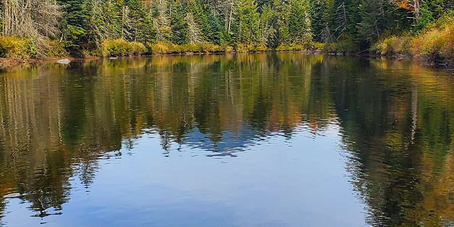
The vitality of the West Branch Ausable River and the reputation of its renowned trout fishery belie a river at risk of losing key stream functions that keep its waters and wildlife healthy, create flood resilience, and keep our local economy strong. Anglers, residents, and stream scientists have noted increased sedimentation in the West Branch Ausable River for at least three decades, and it has only accelerated since Tropical Storm Irene in 2011. Sedimentation and its impacts are most evident in low slope sections of the river, such as the section of the river along River Road near Lake Placid. Here, layers of excess sediment have choked pools and smothered riffles, reducing habitat, angling opportunities, and water quality. Aggrading cobble and gravel have created mid-stream islands that force water against banks, increasing rates of erosion, sedimentation, and bank collapse. Flood events exacerbate the damage leaving public infrastructure and private property vulnerable.
Increased sedimentation, erosion, the loss of riffle-pool structure, and collapsing banks are symptoms of stream disequilibrium – in this case, the capacity of a stream to move sediment efficiently. The causes are most often found upstream and may be a result of eroding soils, weather events, climate change, past or present management practices or land uses, or likely a combination of these. Understanding and resolving the causes in a manner that supports stream health, water quality, and aquatic habitat and reduces costs to local communities, requires thorough, comprehensive assessment.
Ausable Freshwater Center (AFC) staff have followed and studied this growing problem for the past 20 years. In 2005-6, staff catalogued bank height and active erosion for the main channel of the entire Ausable River system. The River Road section of the West Branch downstream to Bassett Flats scored highest in terms of existing bank erosion, vulnerability to further erosion, and likelihood of increasing sedimentation. Further assessment in 2009-10 as part of the NYS Department of State Watershed Management Plan process, identified sites along the River Road section as top priorities for restoration within the entire watershed.
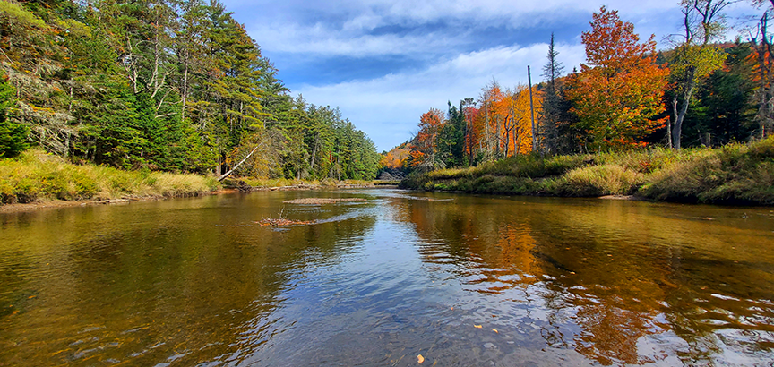
A typical low-slope section of the West Branch Ausable River above Monument Falls. Note the collapsing banks on the right and the sand bar forming in the center of the channel.
Left unstudied is the >90 square miles of land occupied by the headwater streams of the West Branch Ausable and the Chubb River. The West Branch Sediment Study is the product of several years of research and planning to address this critical gap. While this roughly 60 miles of rivers and streams lies primarily in the NYS Forest Preserve in protected Wilderness, over 100 years ago this was one hub of a massive timbering industry and a network of dams and altered streams running logs to downstream mills. Have these industrial scars healed? Are they challenged by a shifting climate with increasingly intense storms? An initial review of US Geological Survey and National Weather Service records suggests that the Ausable watershed experienced a relatively dry period from 1939 to 1979 with few recorded moderate or major storm events. How have large mountain slides contributed to sedimentation of headwaters streams below them; and what of the release of decades of sediment held behind Marcy Dam in the high headwaters, damaged in Tropical Storm Irene and subsequently dismantled by the state? Are there impacts from existing land uses – roads, other small dams? The West Branch Sediment Study is a geomorphology-based assessment that will separate past land use impacts from current ones and natural geologic processes from human influenced ones, quantifying the effects of land uses on sediment relations and channel stability.
This effort lays the foundation for increased flood resilience for local communities in the face of climate change, improved water quality, and enriched in- and near-stream habitat for the West Branch Ausable River. Reduction of sediment loading can keep water temperatures cooler by restoring deep pools. Reducing sediment buildup in the river allows for greater bank stability and can encourage the growth of native plants and discourage invasive plant species.
Why does all this matter? The viability of the West Branch Ausable River is essential to the economy of the Ausable region and beyond. The West Branch is one of the premier wild and stocked trout fly-fishing destinations in the northeastern US and contributes significantly to the local economy. West Branch waters support the quality of life of residents and visitors, snowmaking on Whiteface Mountain and Mount van Hoevenberg, and multiple recreational sports beyond angling and winter sports. At the same time, the West Branch sits within the 6-million-acre Adirondack Park and receives multiple levels of protection on both the private and public lands it moves through. It's health, beauty, and resilience are essential to our communities.
The study is slated to begin in late 2025 thanks to support from the NYS Department of State though a Local Waterfront Revitalization Program grant and generous private donors. Weather permitting, this autumn we will collect high-resolution topographic and photographic aerial data (LiDAR) to update existing datasets. Public meetings to encourage and collect information and observations from residents will help inform goals and objectives as the project develops. A thorough assessment of existing climatic and landscape data will guide our initial field reconnaissance into these headwaters areas. As problems areas are identified and prioritized for further assessment, the field team will collect detailed data on stream functions and analyze trends in channel stability. Our goal is to outline practical science-based solutions that can mitigate excess sedimentation and its effects. Our findings will be shared in a public report with an interactive web map that compile our assessments, recommendations, and conceptual designs for actionable projects to mitigate sedimentation and restore functional habitat.
Restoring the self-sustaining health of the West Branch is essential to the health of its fishery and to protecting public and private infrastructure. It is the foundation for long-term flood resilience for communities, reducing maintenance costs to local and state governments, managing climate risks, protecting habitat and fishery health, and keeping our waters clean for drinking and recreating.
Sign-up for our e-newsletter to get weekly updates on the latest stories from the Ausable Freshwater Center.