Over the past year, Ausable River Association staff have partnered with Lake Champlain Sea Grant (LCSG), the Lake Champlain Maritime Museum (LCMM), and the Adirondack Watershed Institute (AWI) to bring watershed education programs to 5th and 6th graders across the Ausable Watershed. This program is an expanded version of LCMM's Giant Map curriculum.
After successfully running the program at the Keene Central school in 2022, we brought it to the Au Sable Forks Elementary School in 2023. Over time, we hope to share the program with schools throughout the Ausable and Boquet watersheds.
This watershed education program is designed in two parts – with one session taking place in the school and the other session taking place outside the school at a convenient location along the Ausable River.
In the Classroom
Part one of the program teaches students about the concept of a watershed and introduces them to their local watersheds and waterways. The focal point of this day is the Giant (35' x 27') Map of the Lake Champlain Basin, which takes up half an average school gym. Students explore the map, and thus the Lake Champlain Basin, by completing a scavenger hunt. It's incredible to watch as the students discover where and how they fit into the Ausable Watershed and the larger Lake Champlain basin.
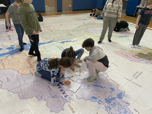
Students explore the giant map while completing an educational scavenger hunt.
To further teach these new concepts during the in-class section of this program, we use other educational tools, such as River Runner or a watershed education model, to help the students visualize how water moves through a community.
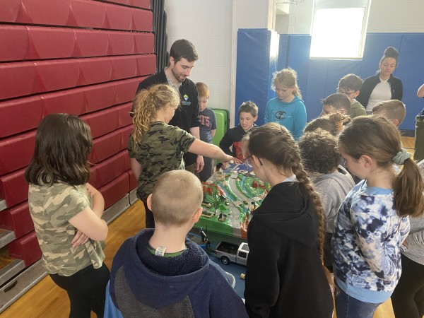
Students learn about the impacts of stormwater runoff on a watershed education model.
In the Field
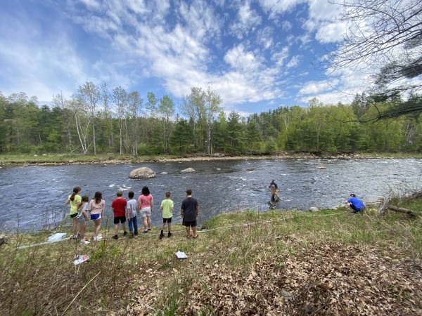
For the second part of the program, we bring the students out of the classroom and to the river. For Keene students, they traveled a short distance by bus to a section of the East Branch Ausable River while Au Sable Forks students simply walked out the doors of their school to access the West Branch Ausable River. While both schools are very close to waterways, few students had interacted much, if at all, with the river. Providing these guided interactions, sometimes for the first time, is a wonderful experience for the outreach team.
This portion of the program is broken into three stations that teach about the chemical, physical, and biological properties of the river.
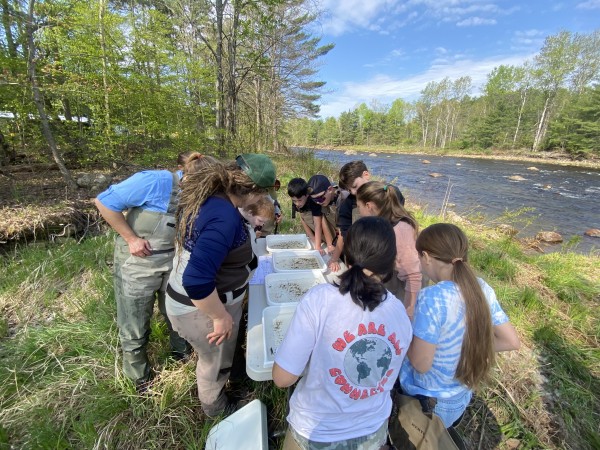
At the chemical station, students use water quality monitoring kits to test the water quality of the river. After grabbing a water sample from the river, students take part in measuring factors of water quality such as temperature, dissolved oxygen, conductivity, and pH. They then learn about what each of these measurements tell us about the health of the river and how such tests determine if the water is suitable for essential fish and macroinvertebrate species.
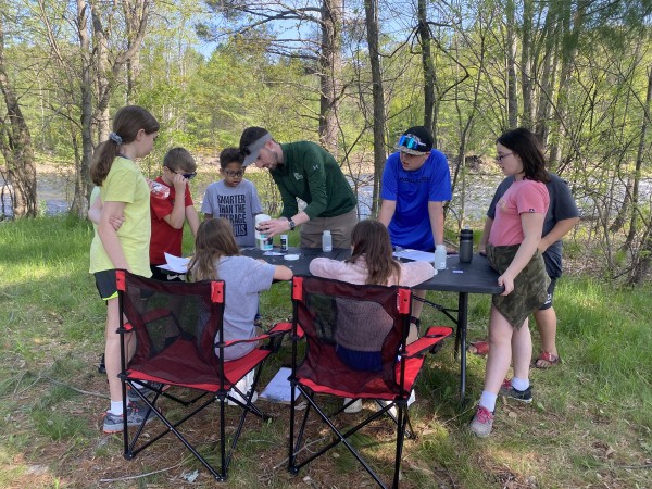
Students assist with testing the water quality of the river.
At the physical station, students learn about the physical characteristics of the river and the surrounding landscape, and how that affects a river’s health. They learn to assess the river by collecting visual information: identifying the composition of the riverbed, noting the vegetation covering its banks, thinking about the recent weather, and taking into account the land uses along the section they are studying. Using a turbidity tube, each student gets to peer into the water to measure clarity and with the help of a tennis ball and some measuring tape they measure how fast the water is moving.
Students measure how fast the river is flowing.
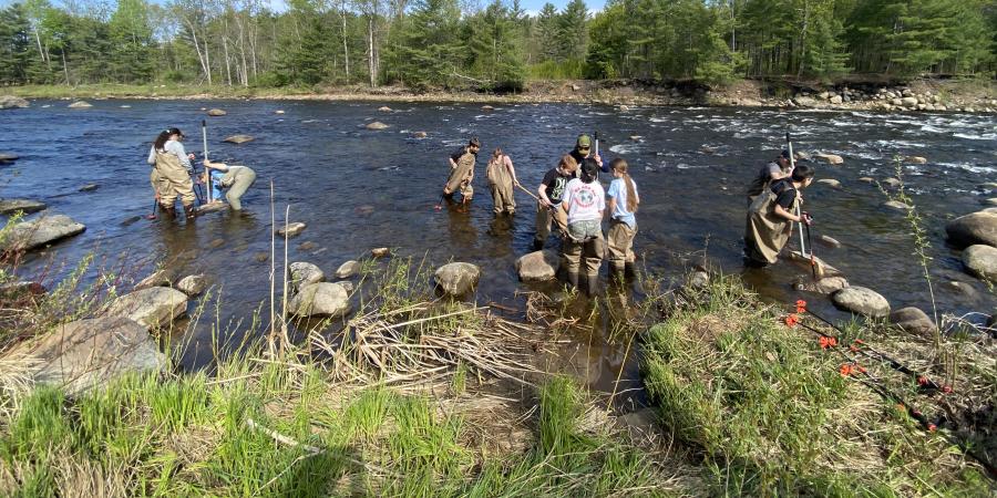
At the biological station, students have the opportunity to don waders and get in the river—a first for many of them. While in the river, they use kick nets to search for macroinvertebrates. After a few minutes, they bring their nets back up to shore and we look through what they caught in shallow dishes. They learn that the critters they caught, or didn’t catch, provide even more information about the quality of the river. For example, some macroinvertebrates can only live in very clean water while others are commonly found in less clean water.
Students look at the macroinvertebrates that they collected from the river.
Once students have cycled through all three stations, we come back together as a larger group and discuss what we learned. Results from each station together provide a good estimate of the river’s overall health. Both the Keene and Au Sable Forks students found their sections of river to be in good health.
~~~~~~~~~~~~~~~~~~~~~~~
It’s a joy to help coordinate this program and play a role in getting kids out into the river, experiencing its beauty, and exploring its health. The joy on their faces when they connect to the river for the first time is priceless. I look forward to continuing to help run programs like this that get kids out into the river.
Story written by Carolyn Koestner, GIS and Science Communications Fellow.
Sign-up for our e-newsletter to get weekly updates on the latest stories from the Ausable River Association.
