In the summer of 2020, the bank holding the Town of Keene water main pipe – that subsequently runs under the East Branch Ausable River – was discovered to be eroded, leaving the water main exposed. The 12" diameter pipe carries approximately 90% of the hamlet's water supply. At the time of discovery, AsRA was offered an opportunity to submit a design for FEMA funds that protected the pipe and provided geomorphic stability and habitat enhancement for the river. Our assessment went beyond the symptom area of the exposed pipe and surrounding unstable bed and banks and moved upstream to the primary geomorphic cause of the instability. The Town of Keene asked us to implement our plan. However, funding for this emergency restoration work was limited to the area immediately surrounding the pipe. This initial phase of restoration was completed in fall 2020 and was summarized on our website shortly after completion.
While the Phase 1 work was protective of the area immediately upstream of the water main, the causes of dysfunction in this reach extended an additional 2,000 feet upstream of the Phase 1 project area. The problems at this site were related to the low slope through this reach of the river. While low slope is not necessarily a cause of disequilibrium in a natural, functioning river, the problem was exacerbated by overwidening of the channel associated with some of the recent high discharge events, most notably Tropical Storm Irene in 2011 and the Halloween storm of 2019. This is a common problem on many sections of the East Branch Ausable River: overwide channels with insufficient energy to transport sediment leading to a build-up of sediment in the channel. These mid-channel sediment bars direct flow toward banks and accelerate their erosion and instability. The overwide, shallow channels are also biologically impaired, with little to no habitat for native brook trout and increased water temperatures. In a natural river system, these problems work themselves out over time as the river readjusts in response to channel-forming discharges by shifting its meander pattern or forming chute cutoffs which can steepen the slope through a particular reach. Unfortunately, roads, buildings, and other infrastructure (like water main pipes) limit the options for natural recovery and may require an intervention to return stream functions that geomorphically stable channels can provide.
Working with the US Fish and Wildlife Service's (USFWS) Partners for Fish and Wildlife Program, Cortland Field Office, AsRA helped perform a detailed survey of the project area to identify design elements that could address the lack of sediment transport capacity and improve habitat. The restoration approach included the use of toe wood and root rap benches to protect eroding banks while reducing the width/depth ratio of the channel. This would improve sediment transport capacity at lower discharges and maintain flows in the active channel, limiting further bank degradation and reducing the threats to homes and infrastructure. Rock vanes constructed of native, natural boulders were used to reduce shear stress along banks and help maintain the design slope through the reach. Pools were established downstream of the rock vanes and along the front edge of toe wood benches, creating diverse habitat. Final design elements included two (2) J-hooks, one (1) converging rock cluster, two (2) toe wood benches totaling 405 feet in length, and two (2) sections of root rap totaling 425 feet in length (Figure 1).
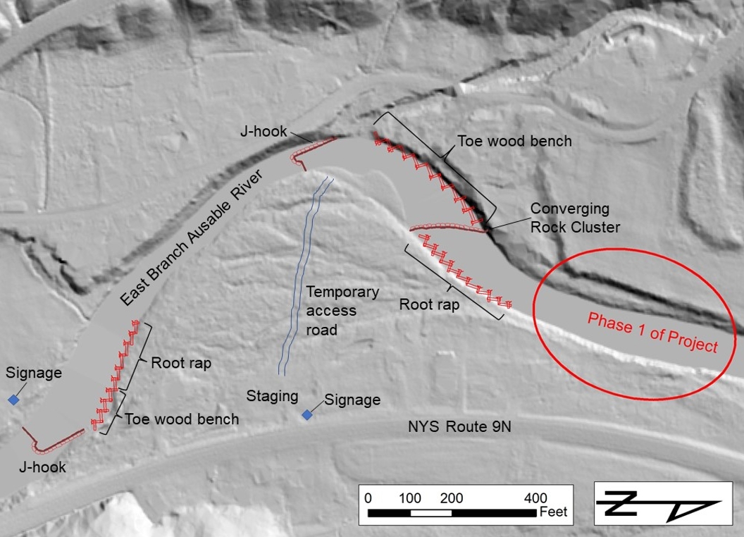
Figure 1. Site plan on a shaded relief basemap showing locations of design elements, signage, staging area, and access road.
Project area is immediately downstream of the Hamlet of Keene. River flow is from left to right in this image.
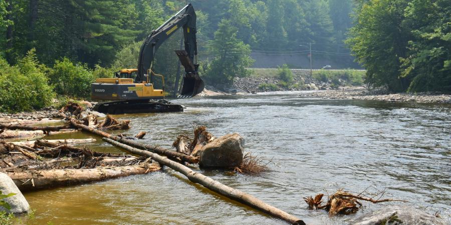
Construction began on July 12. Work began in the upstream portion of the project area and proceeded downstream. Mike Ward, owner of Ward Logging, Inc., obtained locally-sourced, native trees and boulders for the project and used an excavator with a hydraulic thumb to construct the in-stream enhancements according to the site design plan. The precise elevations of rock vanes and benches were based on earlier surveying efforts and are critical to the performance of the project. The use of native materials ensures that the enhancements blend in, over time, with the natural character of the river.
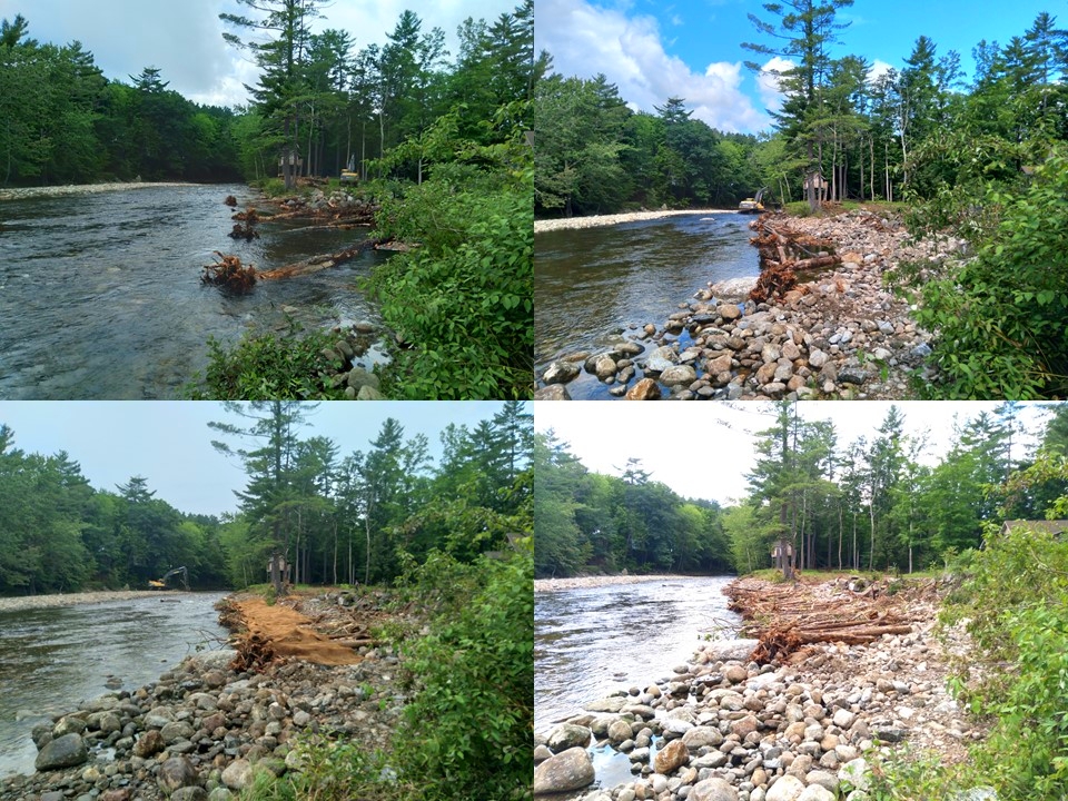
Figure 2. Stages of toe wood bench construction in upstream portion of project site. View is looking downstream. Clockwise from top left: (1) Placement of root wad trees.
(2) Shaping of pools and point bars providesballast to hold trees in place. (3) Brush and small logs are laid down on top of root wad trees. (4) Coir fabric is rolled out on top of brush.
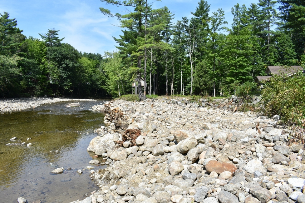
Figure 3. Completed toe wood bench from Figure 2.
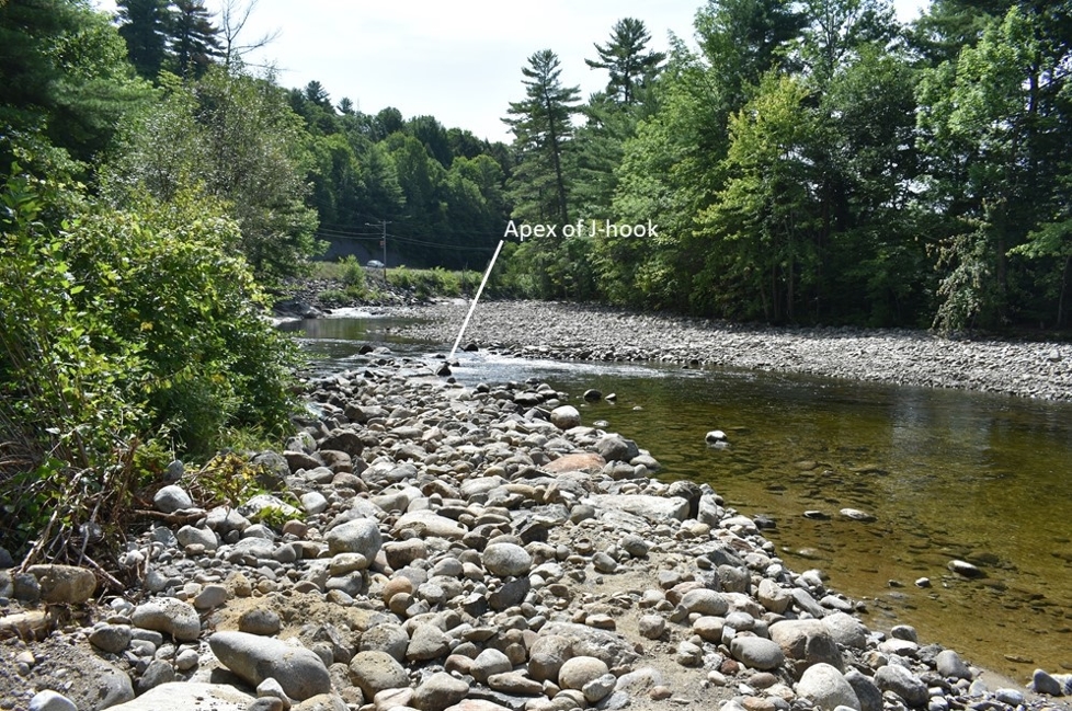
Figure 4. J-hook located at upstream end of project. Photo is looking down the vane arm towards the apex of the J.
Support our river restoration work for clean water and healthy streams. Give with confidence today!

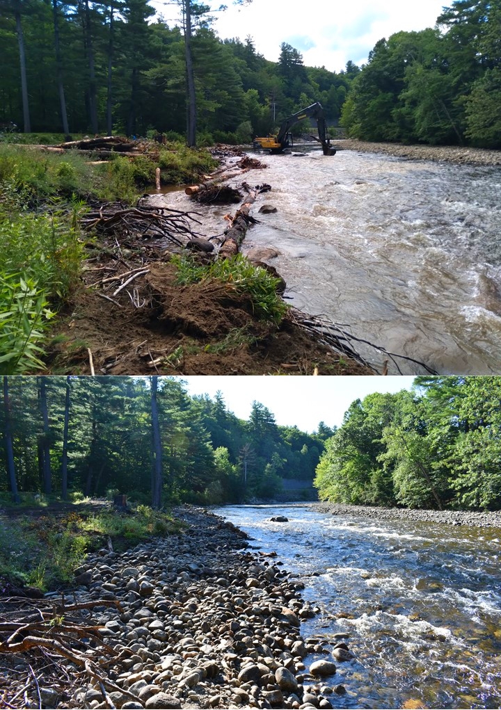
Figure 5. Looking upstream at root rap and toe wood in upstream portion of project area. Top photo is during construction.
Bottom photo is post construction. Note the narrowing of active channel to improve sediment transport.
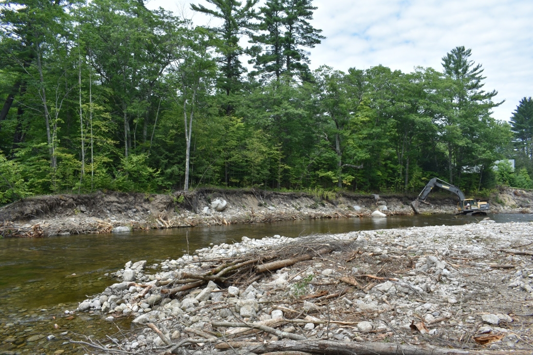
Figure 6. Toe wood bench construction along eroded bank in downstream portion of project site. Root wads are in place. Brush and small logs are being placed on top of the root wads.
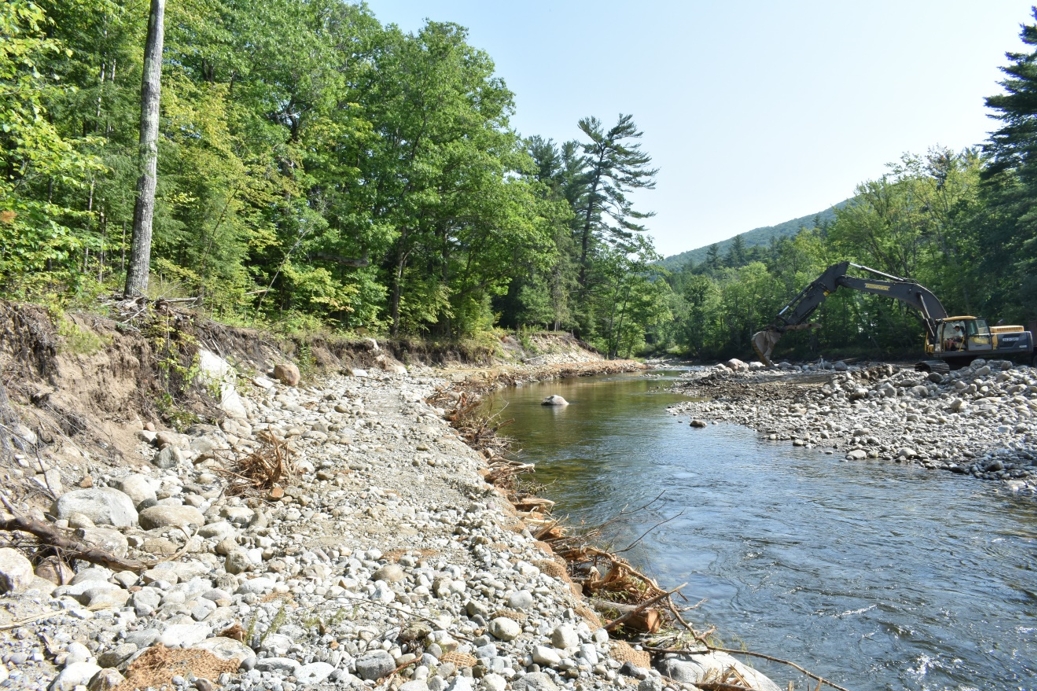
Figure 7. Completed toe wood bench from Figure 6. Photo looking downstream from top of bench.
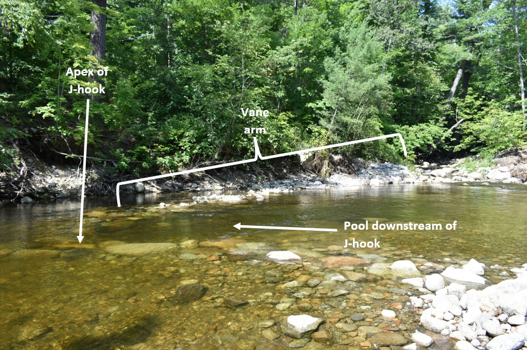
Figure 8. Photo of J-hook in downstream portion of project. River flows to the right in this image.
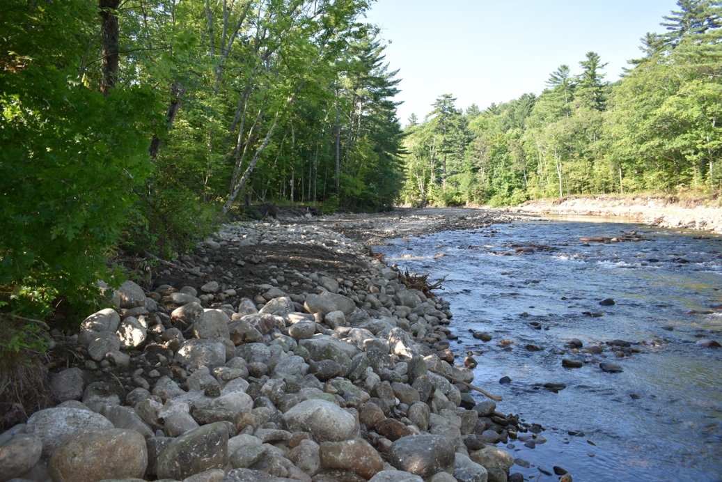
Figure 9. Completed root rap at downstream end of project. Photo looking upstream from end of root rap.
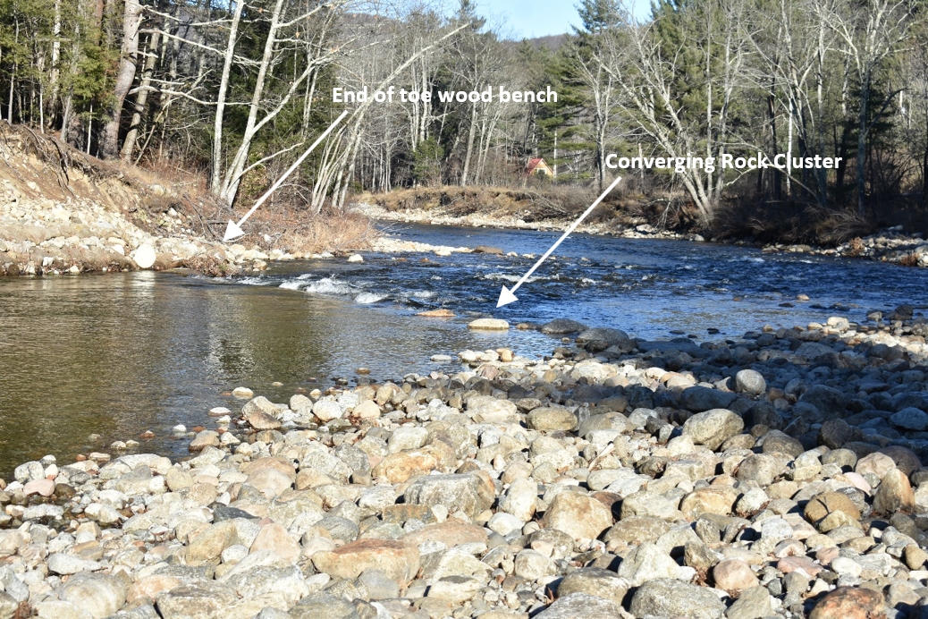
Figure 10. Photo of converging rock cluster at top of riffle in downstream portion of project area.
Construction was completed on August 16. AsRA plans to re-visit the site in spring 2022 to help establish vegetation on the benches. The vegetation will improve the integrity of the benches by counteracting erosive forces with the structure of its roots and further enhance the diversity of habitats in the project area. AsRA continues to monitor all of our restoration sites for a minimum of 10 years after construction to help ensure the design elements continue to function as intended and to help inform our future efforts to restore function to impaired reaches throughout the Ausable River watershed.
This project was funded by an agreement awarded by the Environmental Protection Agency to the New England Interstate Water Pollution Control Commission (NEIWPCC) in partnership with the Lake Champlain Basin Program (LCBP) and funds from the Town of Keene.
Story and photos by Gary Henry, Stream Restoration Manager. Top photo: Construction of a toe wood bench in the Hamlet of Keene on the East Branch Ausable River.
Sign-up for our e-newsletter to get weekly updates on the latest stories from the Ausable River Association.
