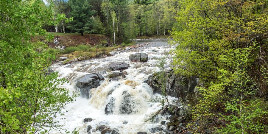
A river's job is to move water and sediment from its watershed to its outlet. The Ausable River is busy taking care of this important work every day. Some days, it moves more water than other days. Sometimes, there's so much water that needs to be moved, that it takes a while to move it all out to Lake Champlain. While it is obvious that rivers move water, and that there are different amounts to be moved at any given time, this begs the question: how much water does the Ausable River and its two branches move in a day, or in a year? Thanks to the work of the U.S. Geological Survey (USGS), we can answer these questions with a little bit of simple math. The USGS maintains a network of stream gages across the county that measure the stage of the river (the depth of the water in the channel), which is converted into a discharge (flow volume per unit time). The USGS reports discharge in cubic feet per second. Instantaneous discharge for a particular second in time can change quite a bit over the course of a day, so they also report mean daily flow (MDF), which is the average flow in cubic feet per second for that day. There are 86,400 seconds in a day, which means that we can take the MDF for a given day in cubic feet per second and multiply this by 86,400 to find out how much water passed a stream gage on that day. Then, we can add up each day's flow to find out how much water passed in a year. Water years are different than calendar years, so we need to adjust our calculations for the appropriate period of time.
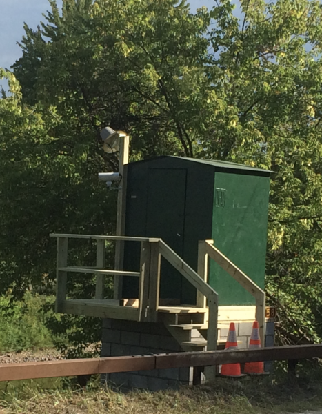
There are three stage discharge stream gages in the Ausable River watershed. There is one gage on the East Branch Ausable River just above its confluence with the West Branch. There is another gage on the West Branch at Monument Falls, between Lake Placid and Wilmington. The third gage is located on the Main Stem Ausable River just below the hamlet of Au Sable Forks. While the gage placement allows us to know exactly how much water comes from the East Branch, the West Branch gage is too far from the confluence to tell us the total amount of water that comes from this part of the watershed. However, the placement of the Main Stem gage allows us to estimate the water yield of the West Branch since there is only one small subwatershed (Palmer Brook) between the confluence of the East and West Branches and the Main Stem stream gage. We can subtract the water yield at the East Branch from the water yield at the Main Stem to get a reasonable estimate of the West Branch water yield.
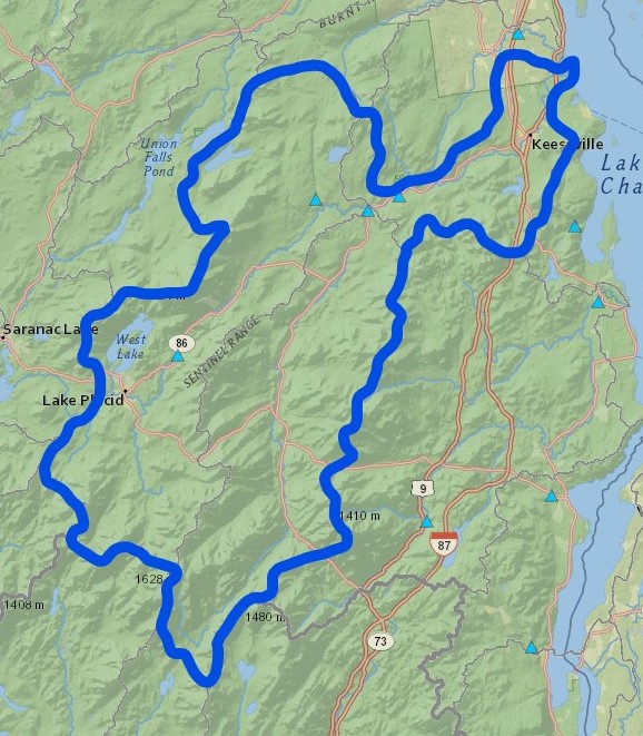
Stream gages (light blue triangles) in the Ausable Watershed (bold blue line). Screenshot from USGS StreamStats Mapper
Support our river restoration work for clean water and healthy streams. Give with confidence today!

Maintaining USGS stream gages is expensive, and the East Branch gage ceased measurements of MDF from September 1995 to March 2016. With the data back online for the 2017 water year, we were able to analyze the water yields of the East and West Branches along with the water yield at the Main Stem gage downstream of Au Sable Forks from 2017 to 2022. It turns out that there is quite a bit of water moving through our watershed each year.
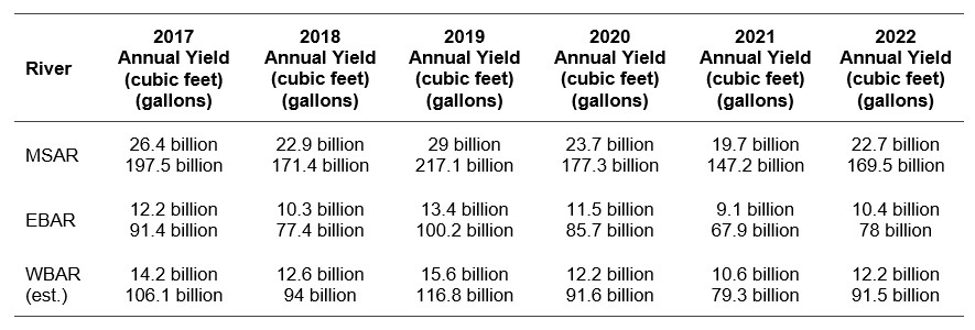
Summary of water yields in the Ausable River/main stem (MSAR), East Branch Ausable River (EBAR), and West Branch Ausable River (WBAR) in cubic feet and gallons for the water years 2017 through 2022. Yields for the MSAR and EBAR are calculated directly from USGS daily discharge data. WBAR yields are estimated by subtracting the annual yield of the EBAR from the MSAR.
It is important to note that these types of analyses would be impossible without the important work by the USGS to gage our nation’s rivers and streams. Much of the foundational work in the fields of hydrology and quantitative geomorphology is based on the knowledge that scientists have gained from collecting and analyzing these data for well over a century. Stream gage data are critical to the work of AsRA’s Healthy Streams program where we strive to restore ecological function and flood resilience to our rivers and their tributaries. From right-sizing culverts to rebuilding channels damaged in Tropical Storm Irene, we need these data to ensure that our designs will withstand the range of discharges that nature produces in this watershed. In hydrology, there are often so many unknown variables that we need to estimate. A USGS stream gage with a long record can take much of the guesswork out of that process and improve public safety and environmental health.
Story by Gary Henry, Stream Restoration Manager.
Sign-up for our e-newsletter to get weekly updates on the latest stories from the Ausable River Association.
