The alarm goes off at 5 am and I wake in bleary-eyed recognition of another field day dawning. It's still pitch dark outside, and I leave the warmth of my bedroom for the promised warmth of the coffee pot. As the stovetop mocha pot hisses and my oatmeal bubbles away, I check through my field pack to ensure I have my map and compass, GPS, first aid kit, headlamp, and enough food and water for the day.
I load my gear into the car and drive out in the dark to my field site, about 45 minutes away. Today, we’re wading up the Chubb River from where it meets the West Branch Ausable River on River Rd in North Elba. I pull up to the parking area just moments after our river steward, Liz Metzger, and we check our packs together once more. We have the battery-operated vacuum pump today, plus hoses, bucket, and battery. Datasheets? Check. Pencils and sharpie? Check. Enough environmental DNA (eDNA) site kits, consisting of a cup, filter, forceps, nitrile gloves, and a bag of silica beads to dry out the filter? Check. YSI multi-parameter probe to measure water quality at each sample site? Check. We pull on our chest waders, tighten our belts, lace up our boots, and load the gear into waterproof bags inside our backpacks. We finish our first and only cup of coffee, pull on our now 20-pound packs, grab our trekking poles, and head down to the river.
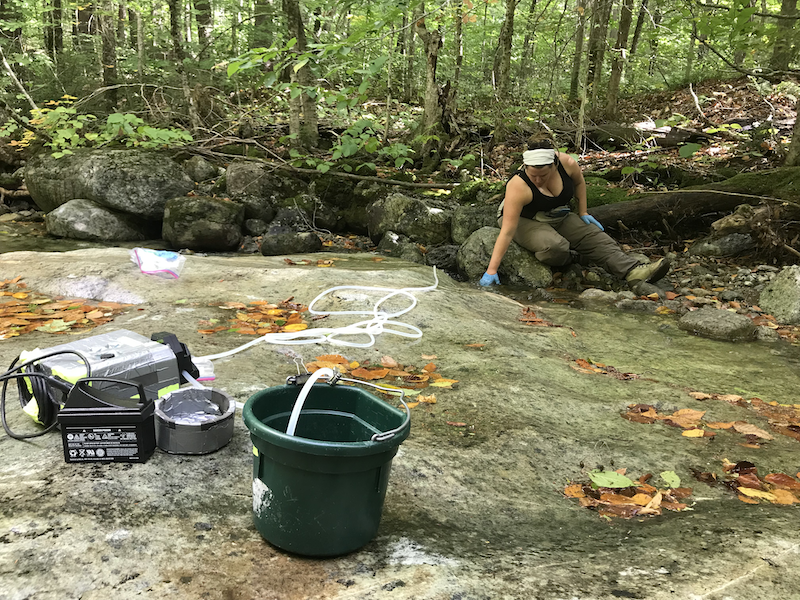
The battery-operated vacuum pump, bucket, battery, and tubing used at sites to filter water.
The river is waist deep, and we can feel the cool temperature through our waders, which cinch tight to our bodies as the air gets squeezed out of them. The backpacks are immediately wet, and we’re thankful we thought of the waterproof bags inside. We walk across the sandy and gravelly river bottom, treading upstream to our first sampling site of the day. We spook several mallard ducks and common mergansers around the first bend, who must think we make a strange pair. About a quarter mile upstream from where we parked, we find a large gravel bar on which to haul out and set up our sampling station.
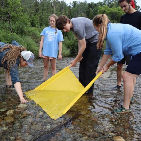
After admiring the myriad animal tracks in the sand under our feet, we undo our packs and remove the pump. While Liz runs the hose through and plugs in the battery, I open a new site kit and put on blue nitrile gloves. It seems a strange place to don personal protective equipment (PPE), but it is one of many assurances that our samples are not contaminated with outside DNA. I move back into the middle of the river, upstream of where we just walked, and hold the cup underwater. As the water is vacuumed through the line, I admire the patterns of the water as it flows around a boulder, my hands, and my legs. I think about the fish and insects beneath the surface, and what they think of my cup. While I filter water, Liz places the probe of our YSI into the river to record water temperature, pH, dissolved oxygen, and conductivity. On our datasheet and sample envelopes, she records the site number, GPS point, date, time, and the number of liters filtered.
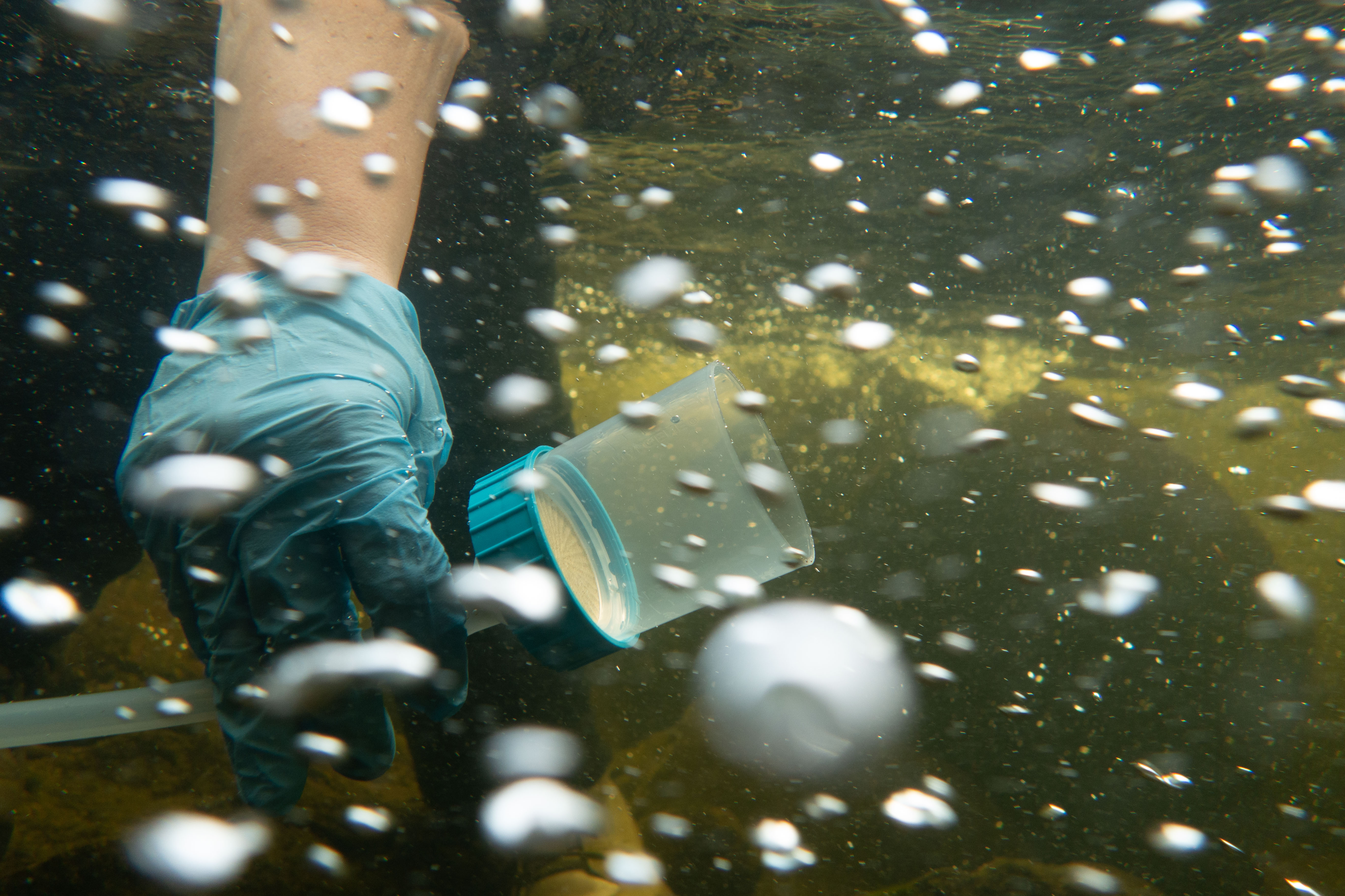
Water filtering through cup while sampling for eDNA. Photo by Meg Modley.
In about 12 minutes, Liz alerts me that we have filtered 5 full liters of river water through the filter cup, and I return to shore. Here, I remove the top of the cup and use sterilized plastic forceps to remove and fold the filter. I place it in a small plastic bag filled with orange silica beads that turn green as they soak up the water and dry out the filter. This stabilizes the sample until it reaches the genetics lab. We return the water to the river and pack everything back into the packs.
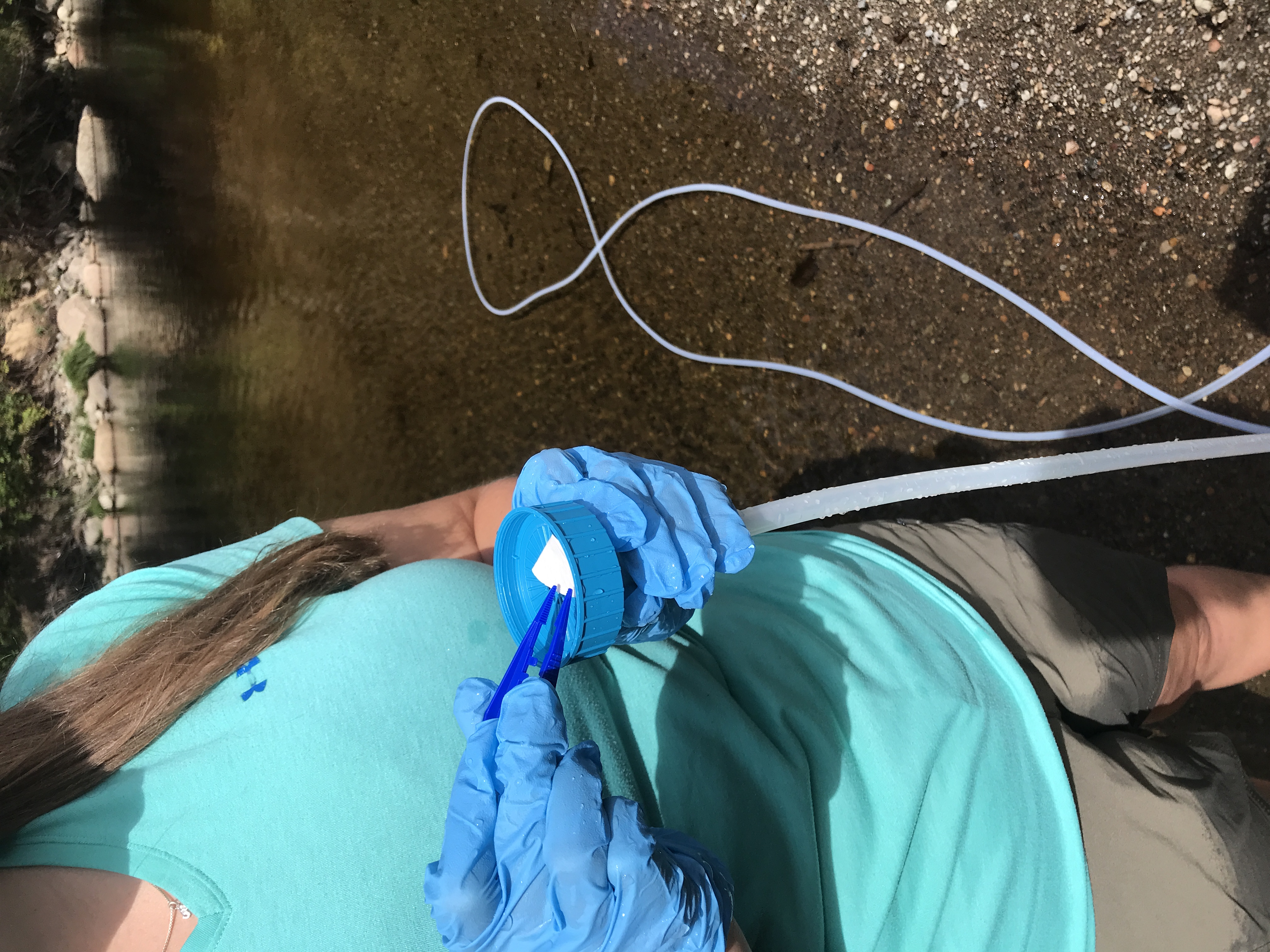
Liz folding the filter that will be sent off to be tested for DNA.
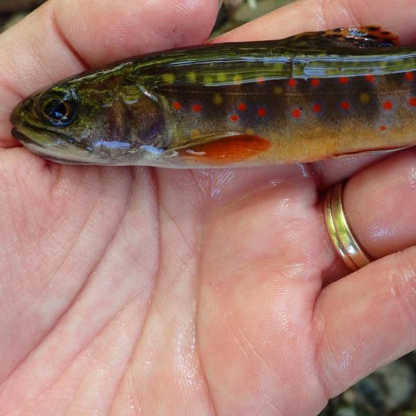
There are many tributary streams that flow into the West Branch Ausable River, and the Chubb River is the largest of these. These tributaries can provide a source of cold, ground-fed water to the West Branch, and surface flow of water laced with nutrients, insects, and drifting food particles that eventually enter the river. In addition to contributing to fish habitat in the West Branch, these streams also offer thermal refuge and spawning opportunities for trout species, including our native brook trout.
Support our work to monitor the health of our waterways; we share what we learn with our community to find practical solutions to ongoing threats. Give with confidence today!

As manager of biodiversity research at the Ausable River Association, I am interested in understanding how trout from the river may utilize the habitat found in these streams, and whether trout that are residents of the streams use the various stream and river habitats available to them. Specifically, we want to determine which species of trout inhabit the streams across the watershed, from the mouth to the headwaters. To answer these questions and effectively map the species distribution of brook trout and other salmonids, we can use environmental DNA. As an alternative to employing traditional fisheries surveys, we filter water from sites every kilometer from the mouth of the stream to the headwaters. We are looking for environmental DNA, which are small fragments of DNA from shed skin cells or waste generated by fish swimming around in the stream.
There are enough DNA fragments floating through the stream for us to capture them in a 5-liter sample of stream water. We filter the water using the vacuum pump and then take the filter back to the genetics lab. There, we run the samples through several stages of processing to extract DNA from the filters, and then use a process called PCR, which allows us to identify the specific DNA fragments from individual species we are looking for (like how COVID tests are run). From here, we can utilize the data to create a heat map of species presence and absence and show the overlap among species in each stream.
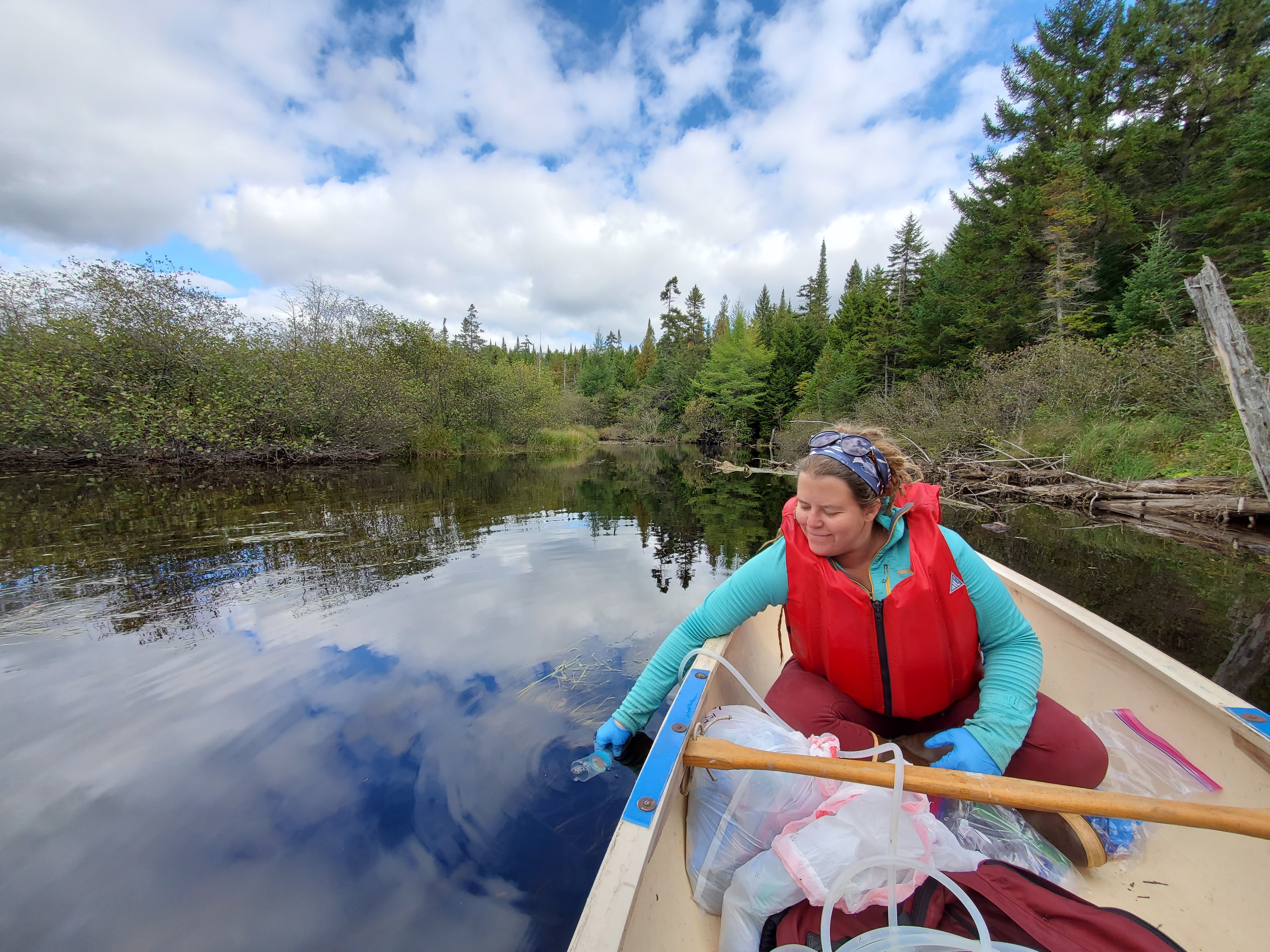
Carrie on the Chubb River filtering water for eDNA.
The Chubb River, and the many other streams that are included in this project, offer extensive habitat for wild brook trout that are minimally fragmented by roads or undersized stream crossings. For the most part, they are unimpeded by waterfalls and other major natural barriers and may offer extremely important habitat for our native brook trout as the summers get hotter. The lower reaches of these streams may also offer important refuge for river-dwelling fish during times of record high water temperatures, as occurred in June and July this past summer. These data will be used by the Ausable River Association for future prioritization of stream reaches for restoration, tree planting, or fish passage projects.
Our first site (A) was in the West Branch Ausable itself (see map below), and our next site will be just above where the Chubb River flows into the West Branch (B). The results from sample A will tell us all fish species that are present within a kilometer above the site, including the Chubb River and the West Branch. Site B on the river will show us what fish are present on the West Branch only. Then, site C will be on the Chubb River and will show us which species live within one kilometer upstream from that point.
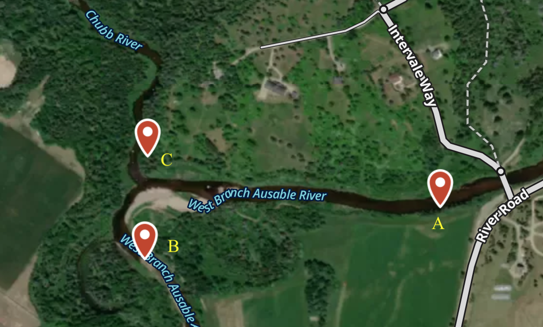
Map of where the Chubb River flows into the West Branch Ausable River.
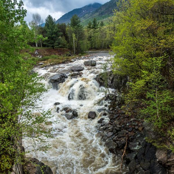
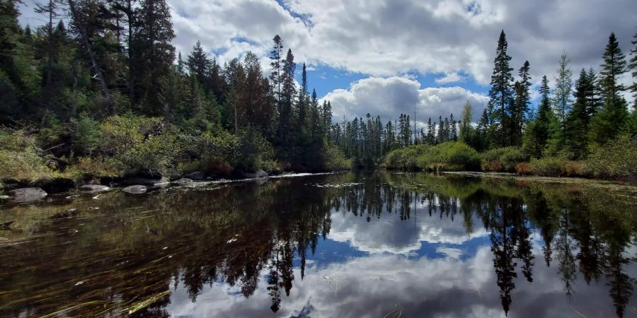
We continue sampling every kilometer (or restart after a confluence with another major stream) all the way up to the Chubb River headwaters. On our first day of sampling, we waded through more than two miles of river length from River Road to Lisa G’s restaurant in Lake Placid. We spent another day of sampling hiking and bushwhacking around Mill Pond and above Old Military Road to Averyville Road, which covered another three miles of river. To go beyond Averyville Road, we needed to bring a canoe and paddle up the Upper Chubb River for 5 more miles, carrying our gear and boat around rapids and over several beaver dams. Finally, the fourth day of sampling took us hiking more than 11 miles to take samples in the marshlands above where we could get to with a canoe and up into the mountains, ending above Wanika Falls along the Northville-Placid Trail. On wilderness lands, we use a hand-operated vacuum pump. It took us four 10-12 hour days of wading, hiking, bushwhacking, paddling, more bushwhacking, and more hiking to cover over 13 miles of Chubb River to sample for fish distribution. The field season afforded us spectacular views, unique wildlife sightings, and some of the most impressive fall colors I’ve ever experienced in New York state. The wading, slippery rocks, and marshy wetlands gave us numerous scrapes, bruises, bug bites, sunburns, and sore and tired muscles. But to me, and to Liz, it was all worthwhile. The data is intrinsically important, and though it may or may not show us that wild brook trout inhabit the Chubb River, it will give us an idea of what this river could look like in a changing future, and what we can do to help it.
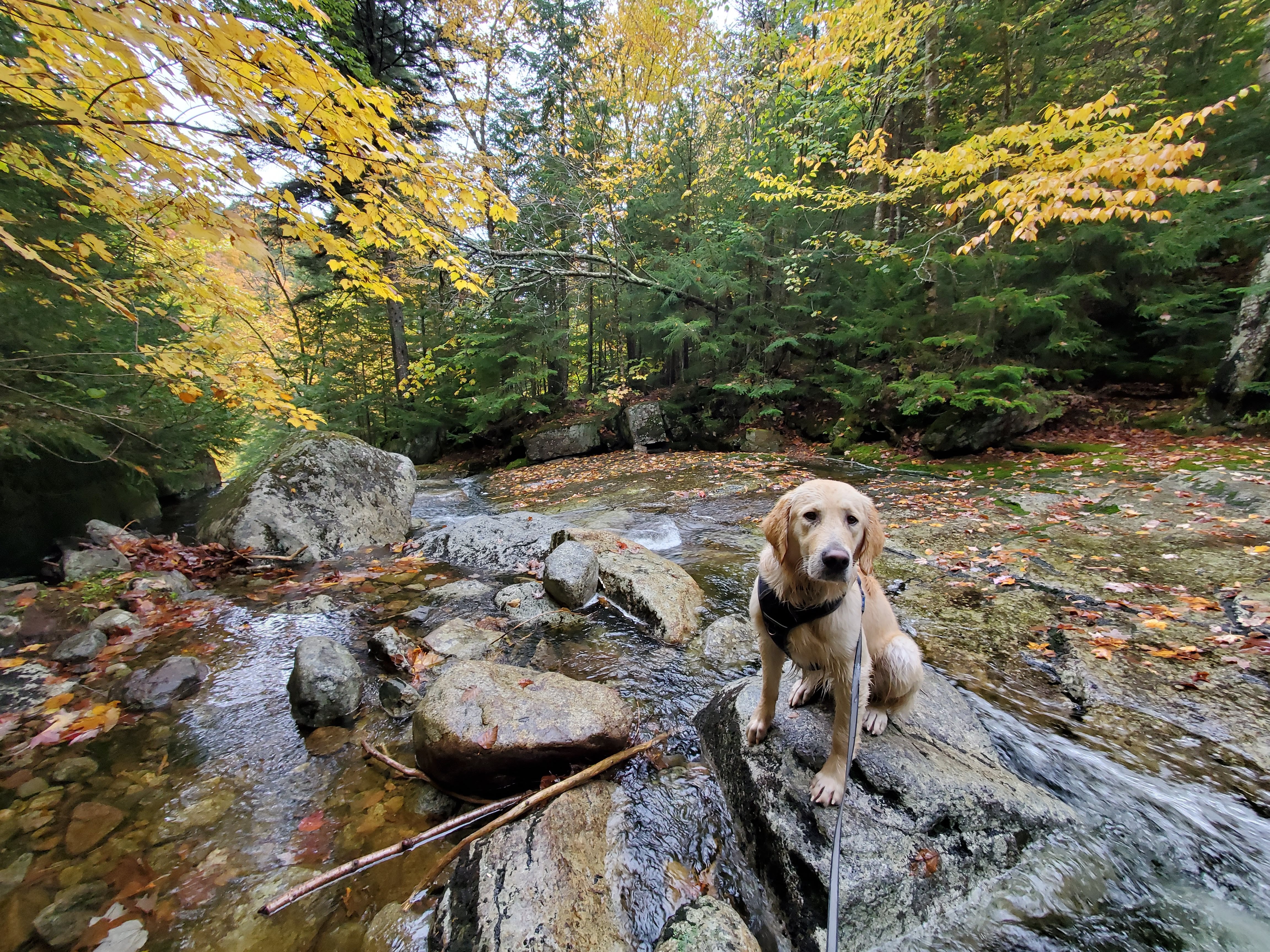
Assistant river steward, Otis, tired after a long day helping to collect eDNA samples in the Chubb River headwaters.
Over the course of the 2021 season, we traveled to over 130 sampling sites across the Ausable and Boquet watersheds to filter water for eDNA. We’re searching for brook trout, Atlantic salmon, rainbow trout, and brown trout in our cups of water. A technical research grant from the Lake Champlain Basin Program makes this project possible and is helping us understand the current fish distribution in areas that have been modeled to continue supporting trout populations in a warming climate. By using eDNA to understand the current distribution of brook trout in these streams, we can understand just how important the habitat is and prioritize future conservation and stream restoration efforts in the Ausable River Watershed.
Written by Carrianne Pershyn, Biodiversity Research Manager
Sign-up for our e-newsletter to get weekly updates on the latest stories from the Ausable River Association.