Nature's Water Infrastructure - A Foundation for Our Communities
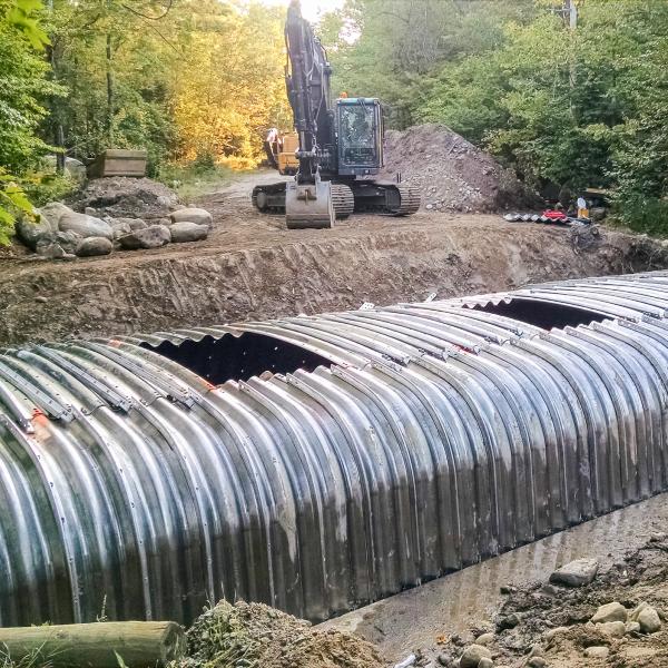
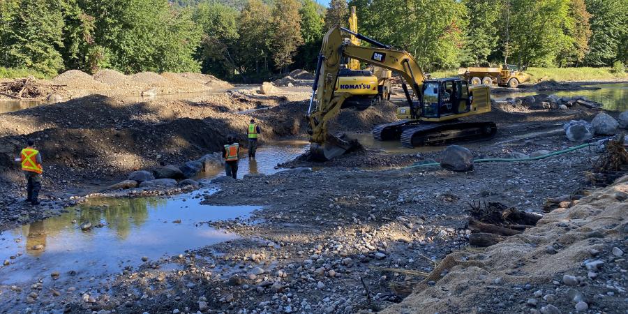
This September, half a dozen large yellow excavators converged on the East Branch Ausable River in Upper Jay. In five weeks, they completed the restoration of almost 2000' of the river channel and banks. Using only native rock and uprooted large trees as building materials, they deepened and narrowed the over-wide channel, rebuilt the riffle-pool system, restored eroding banks, reconnected floodplains, and ensured that wood and sediment (gravel, cobble, and boulders) would move through the system efficiently. In short, they restored a stretch of river making it self-sustaining.
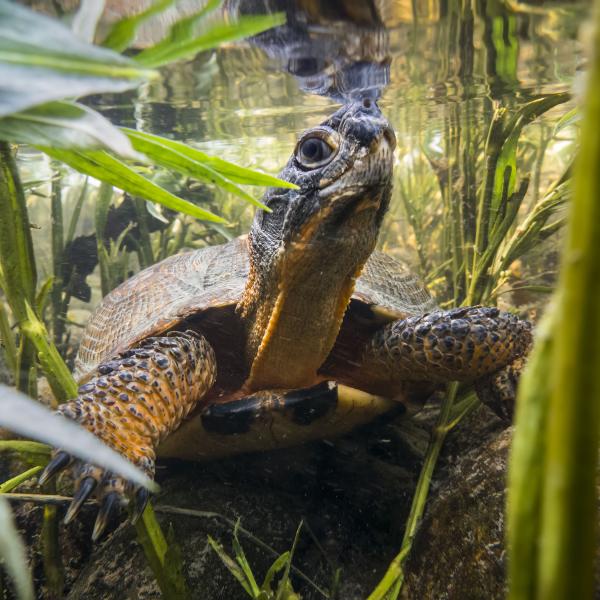
Why bother? Increased flood resilience for the hamlet of Upper Jay, ensuring fewer ice jams, increased instream and bankside habitat for wildlife, and several excellent swimming holes already tested and approved by neighbors.
Site 3, as it is known to the team of stream restoration experts that designed it, was the first of 13 projects completed as part of the Town of Jay’s response to Tropical Storm Irene. It was funded with federal money, through the Governor’s Office of Storm Recovery, and with funds from the Town of Jay. Moving this innovative effort forward required fresh thinking, careful assessment, and time. And the result confirms that what’s good for our streams can be good for the communities along it.
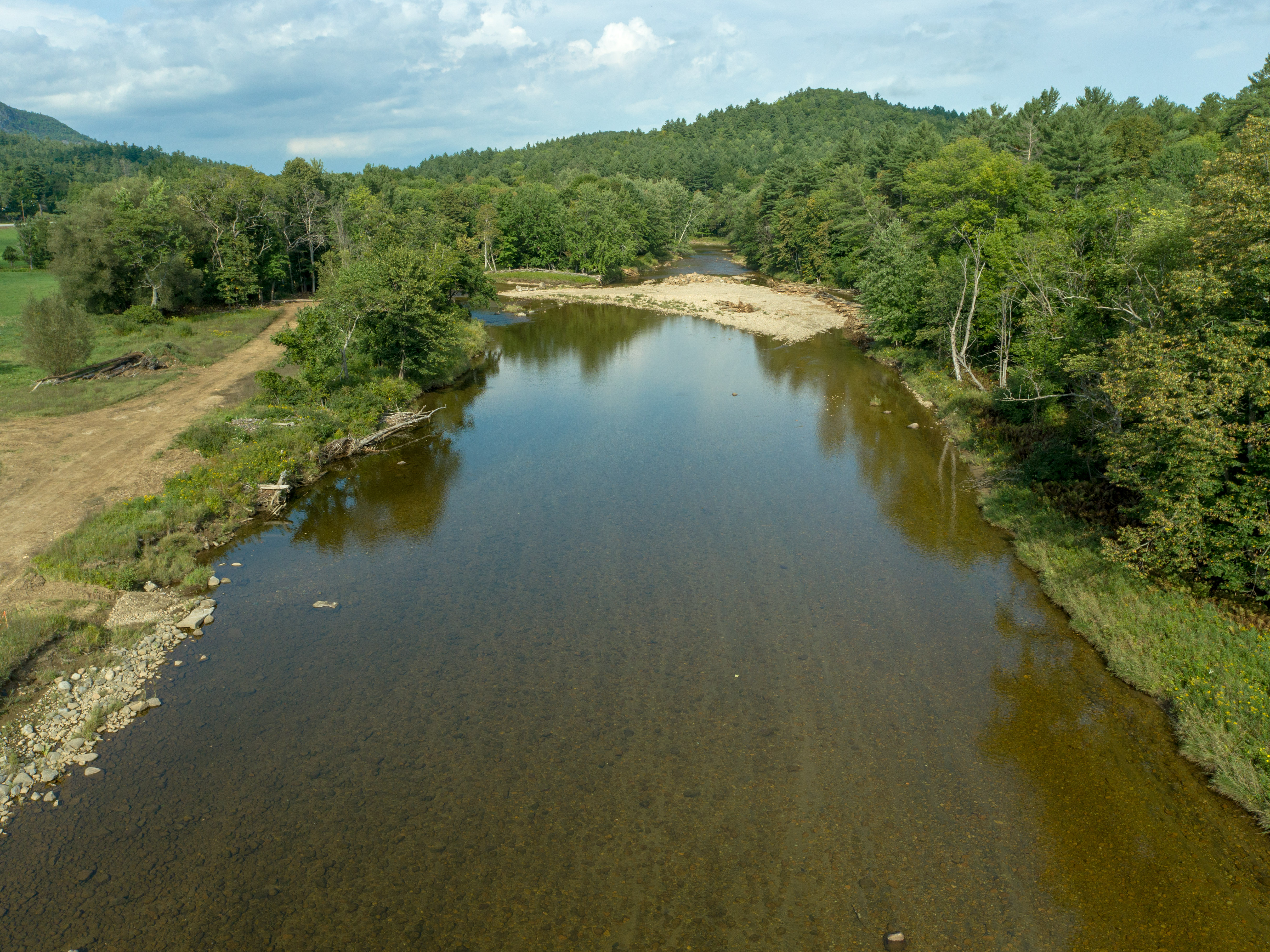
Site 3 in Upper Jay, NY on the East Branch Ausable River before stream restoration.
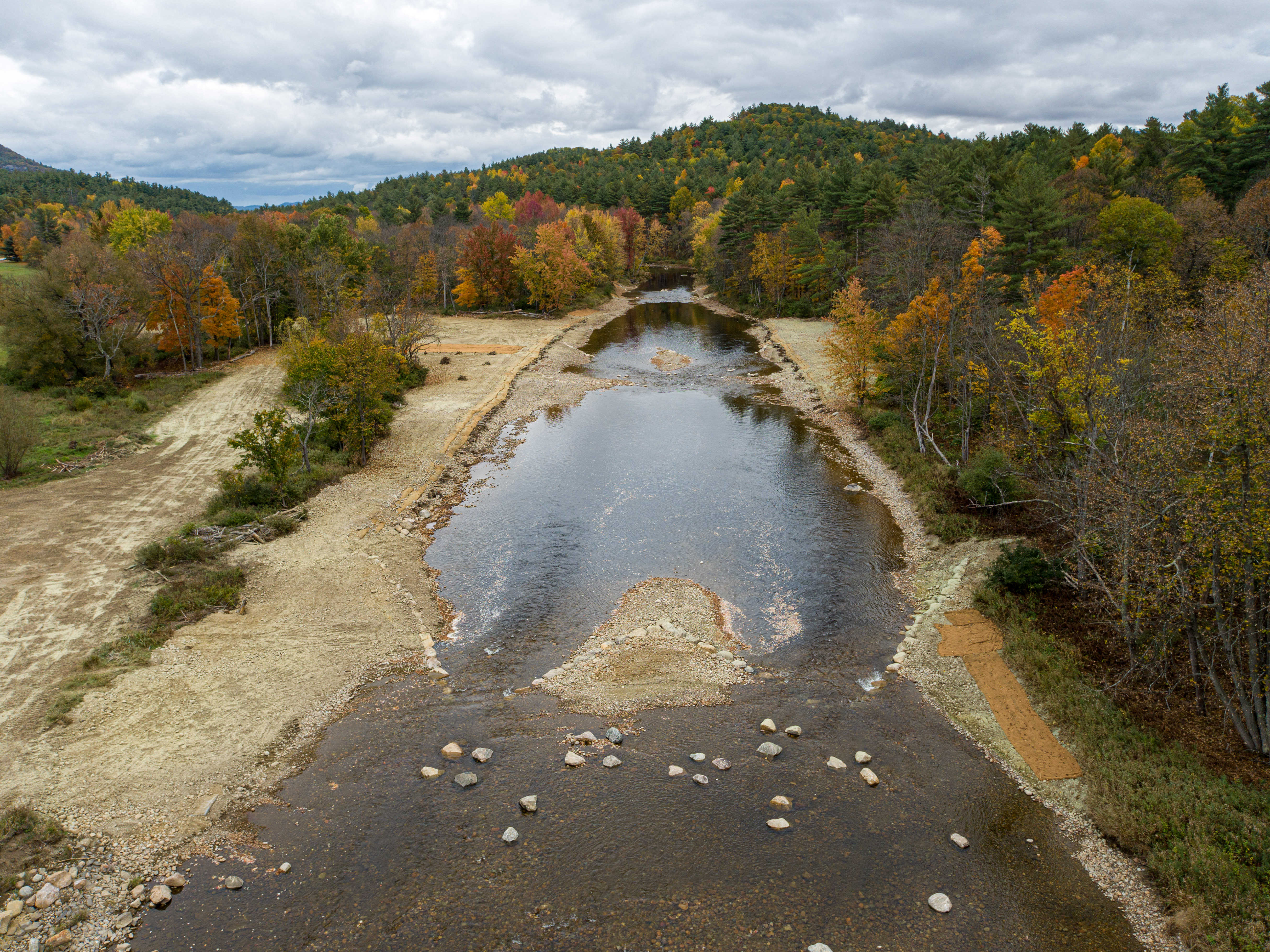
Site 3 in Upper Jay, Ny on the East Branch Ausable River after stream restoration in 2021.
It’s been ten years since Tropical Storm Irene. Picking up the pieces and rebuilding has been an ongoing priority for many communities. Most have pursued improvements in emergency preparedness, communications, and other core social systems to help people manage in big storms. Many have had to rebuild infrastructure – roads, bridges, homes, businesses – and have incorporated risk-reduction strategies as they do so. These might include elevating homes, widening bridges or culverts, and, in extreme cases, moving infrastructure – public drinking water facilities, for example – in flood-prone areas. None of this work comes easy, or cheap, or fast, so making sure it lasts, even with the increasing frequency and intensity of storms and drought forecast for the Adirondack region, is imperative.
All the human infrastructure essential to our lives relies, in turn, on natural infrastructure. In the Ausable watershed, our natural water infrastructure is an essential building block for our communities and their safety, especially in flood emergencies. Where streams are not in balance and cannot function efficiently to build and rebuild their self-sustaining forms, they can threaten homes and communities. Where they travel under roads through undersized culvert pipes, they create erosion and, in storms, become water cannons capable of flooding roads and undermining pavement. Where wetlands are filled and floodplains cut off from their streams, they cannot absorb flood flows, leaving downstream communities inundated. All these truths were demonstrated during Irene.
Moving forward to repair and build back better, our efforts will be only as successful as our natural waterways are healthy. Figuring out what streams and rivers require – giving them room to roam in floods by moving infrastructure off their floodplains, helping them repair and regulate themselves through the use of natural stream restoration methods – is essential to rebuilding in a way that reduces risks for people. Increasingly, these assumptions are informing the rebuilding for the next storm and the work needed to adapt to our changing climate in a way that is cost-efficient and effective.
Support our river restoration work for climate resilience, clean water, and healthy streams. Give with confidence today!

The process that led to the construction of Site 3 was years in the making. Historically, beyond the damage from a century of log drives, this section of the river was heavily mined for road gravel until the 1970s. This practice removed the river’s riffle structures – the bony shallow areas that are essential to maintain the river’s slope. The Ausable River Association’s 2008 Watershed Management Plan Strategy identified this section of river as a priority for assessment and restoration. But funds were lacking at the time. In 2012, in response to the devastation of Irene, the NYS Department of State led a series of public meetings and working groups involving citizens, businesses, and non-profits from the Towns of Keene and Jay, where the flooding was concentrated in the North Country. This resident-driven process created the New York Rising Community Reconstruction Plan of 2013. The plan listed the restoration of streams, protection of floodplains, and replacement of undersized culverts as priorities for action, among many other projects. Each of the two towns received $4.5 million in storm recovery funds. That money began to move critical Rising Community projects forward, but not those concerned with stream restoration.
In 2018, the Town of Jay, assisted by the Governor’s Office of Storm Recovery, Essex County, and a team of stream restoration experts including the Ausable River Association (AsRA), took the next big step. Thanks to additional grants and cost savings, the Town of Jay was able to apply the remaining storm recovery funds to a project of its choice. The Town board, acting on behalf of the community, chose the restoration of the East Branch Ausable River. That decision led to the 2019 East Branch Restoration Plan for the lower half, or Town of Jay, section of the river with its 13 recommended projects. Sites 2 and 3 were designed in 2020 and put out to bid for construction in 2021. Site 3 was completed this fall.
The work of stream restoration – especially the effort to fund each project – can be slow and painstaking. Nevertheless, since Tropical Storm Irene soaked the Ausable watershed, AsRA, working with the U.S. Fish and Wildlife Service, has completed 10 natural stream restoration projects – restoring over 8,000 linear feet of channel. In the same ten years, working with The Nature Conservancy–Adirondacks and other partners, AsRA has replaced 11 undersized culvert pipes on brook trout streams with wider, climate-ready culverts or bridges, eliminating town maintenance costs, creating flood resilience, and rebuilding habitat connectivity and stream health. All this work was funded separately from storm recovery, with a combination of competitive grants and contributions from donors, towns, and landowners.
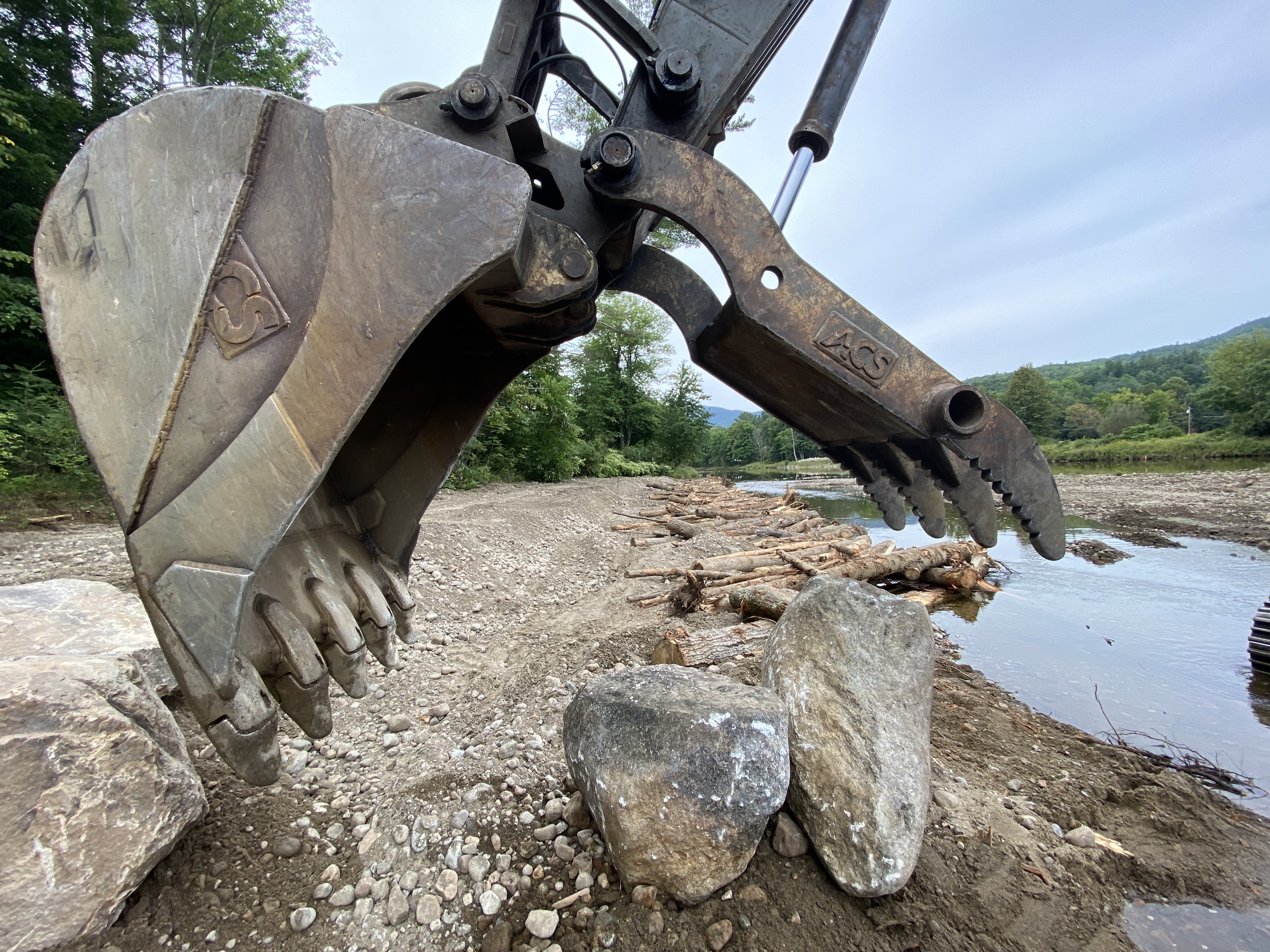
Large equipment is necessary during restoration projects to precisely place uprooted trees and boulders.
More projects are underway. Two of these – Site 2, just upstream of the Upper Jay bridge, and Site 13 in Au Sable Forks, above Grove Island – will alleviate flooding and ice jam impacts in these two hamlets where roads, homes, and businesses sit in floodplains, complicating the river’s access to them. Past storm responses have removed some of this infrastructure, but the financial and human cost of removing more is too high. AsRA and its stream restoration design partners see a way forward for each site that will balance human needs and fulfill the needs of the river.
Comprehensive assessment and planning – such as the East Branch Restoration Plan – is the best path forward for building community resilience and stream health. The science-based, solution-oriented planning process addresses root causes, ensures that each project contributes to overall system health, and is cost-effective. For example, AsRA requested grant funds this year to implement two more comprehensive scientific assessments. One focuses on the upper West Branch Ausable River, where accumulating fine sediments choke pools and smother riffles, intensifying bank erosion and reducing water quality, angling opportunities, and flood resilience. The second would create an East Branch Restoration Plan for the Town of Keene’s upstream half of the East Branch, where the increased size and availability of sediment is eroding banks and reforming channels – at times challenging infrastructure present for decades. Each assessment will identify projects to protect and restore floodplains, riparian buffers, channels, and banks. These projects will be prioritized and implemented with community input.
The Ausable is a beautiful river that defines our region. It draws us in to watch its many moods, to find solace and energy. We have the chance to repair the weaknesses caused by storm damage, past industry, and management practices that did not account for negative consequences to streams. A chance to restore a healthy, self-sustaining river. We’ve begun the conversation as a community and learned a great deal since Irene. Let’s continue the conversation and the work.
Story by Kelley Tucker, Executive Director.
Sign-up for our e-newsletter to get weekly updates on the latest stories from the Ausable River Association.